Industries / Construction and property
Real estate
The real estate industry buys, sells, rents out, values and manages land and buildings, and keeps the records of who owns them.
1858
South Australia's Real Property Act, passed on 27 January 1858, made ownership of land pass by an entry in a government register instead of a chain of private deeds; the system, named Torrens title after Robert Richard Torrens, spread to New Zealand, the other Australian colonies, Malaysia and some US states.
40
Milestones achieved across 6 domains.
9
To watch for: announced, not yet confirmed outside.
12
Open deliverables. Nobody has shipped them.
In one minute
Where it started
Land was rented under written rules in Hammurabi's Babylon, nearly 4,000 years ago. The modern trade took shape in the 1800s. South Australia made ownership pass by an entry in a public register in 1858, London surveyors formed the profession that values and manages property in 1868, and US real estate boards were pooling their listings by the 1880s.
Where it stands
Savills, a property adviser, puts the value of the world's real estate at $393.3 trillion at the start of 2025, of which $286.9 trillion is homes. Listings, price estimates and rental ads have moved online, and rules made since 2023 now govern US agents' pay, rent-setting software and repair deadlines in English social housing. Much of the daily work still rests on documents read and photos judged by people.
What is open
The open jobs are mostly public tests and datasets that nobody has made: which listing photos were altered, what a lease says, whether an AI title search missed a lien, what caused the damp in a flat, and what a building's data points mean. Companies sell tools for several of these jobs but publish only their own accuracy figures, or none. AI models that read documents and photos, and web agents that search public records, put this work within reach of a student or a small team.
Domains
AchievedWatch forOpen
Domain
Progress
Last achieved
Watch for
Open
Listings and search
This is how property for sale or rent is advertised and found: agents' shared listing databases, public websites, photos and tours, and the data formats that move listings between systems.
7 · 1 · 2
Last achievedClear Cooperation, then loosened2019
Watch forPrivate listings and sale prices
2
openValuation
This is estimating what a property is worth, whether by trained appraisers (called valuers in many countries), by price indexes that track a whole market, or by computer programs called automated valuation models (AVMs).
7 · 1 · 2
Last achievedRules for automated valuations2024
Watch forRules for AI in valuation
2
openIn depthAppraisal
Sales and title
This is moving ownership from seller to buyer: the contract and the agents' pay, the closing (called conveyancing in many countries), the public register of who owns what, title insurance, and protection against forged transfers.
7 · 2 · 2
Last achievedAI reads old deeds2024
Watch forTokenized title deeds in Dubai
2
openIn depthTitle and escrow
Leasing
Leasing is renting property out: finding and screening tenants, setting rents, writing the lease contract, and accounting for leases.
7 · 2 · 2
Last achievedPooled rent data reined in2025–2026
Watch forAI agents answer rental inquiries
2
openProperty management
Property management is looking after rented property for its owner: collecting rent, arranging repairs, dealing with tenants and meeting the rules on housing condition.
5 · 1 · 2
Last achievedEngland ends no-fault evictions2026
Watch forA national register of landlords
2
openIn depthProperty management
Running a building
Running a building means operating it day to day: its heating, cooling and ventilation controls, its lifts, its energy use and reporting, and its safety records.
7 · 2 · 2
Last achievedEmissions caps on buildings2024
Watch forAI runs heating and cooling
2
open
Other narrower industries
Short-term rentalsPropTechHome inspectionSelf-storageCoworkingRV parksParkingCommercial real estate brokerage
Figureheads
4 people
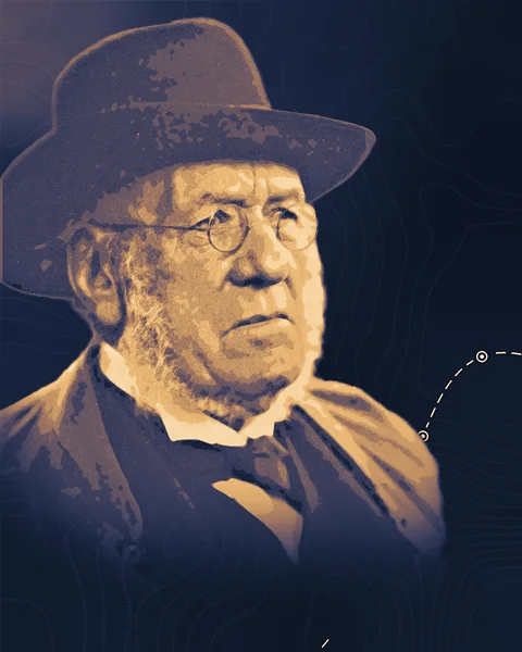
John Clutton
1809–1896
A London land agent who valued and managed the estates of the Church and the Crown, he was the first president of the body that became the Royal Institution of Chartered Surveyors, which still sets the rules its members follow when they value property.

Robert Richard Torrens
1814–1884
He led South Australia's change to land title by public register, so ownership passes by an entry the state guarantees instead of a chain of old deeds.

Octavia Hill
1838–1912
She showed that rented homes for the poor could be repaired, run and made to pay by managers who called on every tenant each week, and trained the women who made housing management a profession.

Robert Shiller
born 1946
With Karl Case he built repeat-sales house price indexes that the US housing market and its regulators still measure prices by, and he argued that home prices could run far ahead of their worth.
Advances to build with
1 research note

Open in real estate
3 of 12 open deliverables
Open · Listings and search
Altered photo test set
A public set of listing-style photos with known edits, and a detector scored against it. Photograph rooms and house fronts you have the right to use, then make the edits listings use: a blue sky swapped in, a greener lawn, power lines or clutter removed, and virtual staging, which adds furniture that is not there. Keep every original, so each edited photo has a known answer.
Built with what exists
A phone camera; image editors with AI fill and virtual-staging services to make the edits; the C2PA Content Credentials standard, which can record edits inside the image file; an AI model that reads images, such as Claude Fable 5.2 (see the Note "Three working devices"), as one baseline; Label Studio for labels; Hugging Face to host the set.
Open · Valuation
A valuation test run ahead
A public leaderboard that scores automated valuation models only on sales that had not been recorded when each model was frozen. Each month, every entrant's model is saved with a timestamp. When HM Land Registry publishes the next month's prices, the leaderboard runs each saved model on those sales and scores it. No model can have seen the answers.
Built with what exists
HM Land Registry's Price Paid Data, which covers sales for value in England and Wales, is updated monthly and is released under the Open Government Licence; Energy Performance Certificate data for floor areas; the Cook County Assessor's published valuation code as a model to adapt; Python; a scheduled job on GitHub Actions, whose commit history gives each saved model a public timestamp.
Open · Sales and title
Deed-to-map accuracy test
A public test of how well software turns the written boundary in a deed into a shape on a map. Many US deeds describe land by metes and bounds, a chain of compass bearings and distances from a starting point. Collect modern deeds from counties that post records online free, take reference outlines from recorded surveys where they exist and from the county's parcel map otherwise, and score each tool's shape.
Built with what exists
County recorder websites and county parcel map layers; an AI model that reads documents, such as Claude, to pull out each call, with a second checking pass (see the Note "Seven more flagged"); Python with the Shapely geometry library; QGIS to inspect the results.